
Finding Who Lives on a Bountiful Street
A Bountiful street directory begins with the physical address, but an address alone does not establish a current resident. Start with the Davis County Property Search GIS. Search by Address or Parcel ID, select the dropdown match, click the parcel, and open Parcel Details. Follow Tax Information for the parcel ID and legal description. That gives the search a stable land key before a name is tested.
Move from place to person in small steps. The owner shown in property data is not always the person who lives at the situs address. A mailing address may be off-site. A voter entry belongs to a registered voter and can be protected or missing. A deed names parties to a recorded transaction, not every household member. The street directory is therefore a chain of evidence, not a single roster.
- Enter the physical address in Davis County Property Search and choose the match.
- Save the parcel ID, legal description, situs address, mailing address, and the date shown by the county data.
- Take ownership questions to the Recorder and search the parcel, owner, entry number, or deed fields.
- Use Utah Voter Search with a name plus street, city, or ZIP to test a registered-voter connection.
- For an older address, compare the legal description with directories, census years, deeds, cemetery records, and the 1917 Sanborn map.
That path is slower than copying an unverified name, but it makes a Bountiful street search repeatable. It also helps separate present parcel ownership from a past occupant or a person whose mail is sent elsewhere.
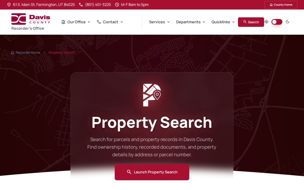
The Recorder property-search capture shows the address, owner, parcel, and document-entry routes that feed a street directory search.
Bountiful Records Searchable by Street
Several record sets can be keyed to a Bountiful address, though each answers a different question. The table keeps the sources in their proper lane. A parcel record is about land. A deed is about a recorded instrument. A voter search is about registration. A city request may reveal a public permit or complaint if the custodian classifies it as open.
| Record set | Keeper | What an address may reveal | Access |
|---|---|---|---|
| Assessment / parcel card | Davis Assessor | Ownership context, parcel, situs or mailing address, value and legal-description links | Property Search map |
| GIS parcel map | Davis County GIS | Boundary, adjacent parcels, map location and detail link | Public map; zoom and click |
| Recorded deed | Davis Recorder | Grantor, grantee, document type, dates, book/page, entry number and legal description | REDI-Web, terminal, or copy request |
| Voter record | Utah voter system | Registered voter fields tied to street, city, ZIP and address status | Individual lookup; protections apply |
| Permit or code file | Bountiful City or county | Address, project or complaint trail, subject to classification | City GRAMA; no public index located |
The county does not document a street-export button or a bulk list of residents. Browse parcels one at a time, and keep a note of what was actually visible. A street directory is strongest when the map, deed, and dated person record agree.
Map the Bountiful Parcel and Street Segment
The county's parcel instructions say to zoom until parcel boundaries appear, use Address or Parcel ID, enter the value, choose the dropdown result, click the marked property, and read Parcel Details. A whole street segment can be inspected by panning and clicking adjacent parcels. The map is informational, can be about 24 hours old, and is not legal evidence.
Ownership, address, tax-unit, and legal-description questions go to the Recorder. Value questions go to the Assessor. Tax questions go to the Treasurer. This matters when a street search produces a mailing address that does not match the mapped Bountiful property. Preserve both addresses and label them instead of treating them as the same place.
| Control | Use in an address search |
|---|---|
| Search by Address | Type the physical address and select the correct dropdown result. |
| Search by Parcel ID | Use the county identifier when address spelling or numbering is uncertain. |
| Parcel map click | Zoom to parcel lines, then click each target or adjacent parcel. |
| Tax Information | Bridge from the parcel result to parcel ID and legal description. |
Use the legal description when a plat, subdivision, lot, or unit is the better historical key. Street text can change. A lot and block reference may carry the record trail across a new sign, spelling change, or renumbered address.
Carry the Parcel Into the Bountiful Recorder
The Davis County Recorder's Property Search page documents owner name, property address, parcel or serial number, and document entry number routes. REDI-Web adds Party Name, Entry Number, Book/Page, Development, and Location, with image and abstract options. Use the parcel ID or legal description from the map first, then test the owner and address. The parcel is the bridge between a street and a deed.
The Recorder says land records reach back to 1850, historical land records to 1870, and computerization or microfilm is marked at 1981. REDI-Web help places indexed document tools around 1983. When an online result stops, use the public terminal at 61 S Main, Suite 106, Farmington, Monday through Friday, 8 to 5, or request a copy through the office. FamilySearch and Archives provide separate older-book routes.
A sample Davis entry contains entry number 3013431, recorded and execution dates, book 6741 and pages 1132 to 1133, deed type, consideration, recording party, fee, return-to party, grantor, grantee, land serial number, vesting, and subdivision lot or unit. Save these fields when visible. They distinguish two people with the same surname better than a name alone.
REDI-Web access is subscription-based. The current Recorder page lists $25 per month, while copies and downloads can add charges. Research notes compare digital copies at $1 each with office copies at $2 per page and about 5 to 10 business days for an office request. Check the current price before ordering.
Street Address Terms for Bountiful Records
Three address fields often appear close together but mean different things. The distinction is central to a careful Bountiful street directory.
- Situs address
- The physical location mapped to a parcel. Use it for GIS, parcel work, street browsing, and address-linked requests.
- Mailing address
- The place used for tax notices or owner correspondence. It may be away from the Bountiful parcel and does not prove residence.
- Legal description
- Lot, unit, subdivision, block, or metes-and-bounds language that can survive a street spelling or number change.
- Plat
- A recorded map that sets out lots, blocks, units, roads, and other land geometry.
- Criss-cross directory
- An older reverse directory arranged by address, useful for a dated occupant clue rather than a current roll.
Write the field label beside every value. “Address” without a label is not enough for a deed, parcel card, voter entry, or historical directory.
Read Deed Parties Along a Street
Grantor means the party transferring an interest. Grantee means the party receiving it. A deed chain can move backward from a current recorded owner to a prior seller, but a recorded party is not automatically a resident. Mortgages, liens, plats, military-discharge recordings, and other instruments may also name people or organizations connected to the parcel.
REDI-Web's Location search uses town and range, while Development can help with subdivision records. Book and page provide another land-record key. The office will index and provide copies, but it does not perform title research, interpret legal documents, give legal advice, notarize, or supply phone legal descriptions. Ask a focused question and retain the answer in the source note.
For a street directory, the best sequence is address to parcel, parcel to legal description, legal description to entry or deed, deed to party, and party to a dated voter, directory, court, or historical record. That sequence can show who owned land, who signed a transaction, and who appeared in a separate source at a particular time.
Use Voter Search as a Bountiful Check
Utah Voter Search shows First Name, Last Name, Date of Birth, Street Address, City, and Zip. Public voter information can include name, physical or mailing address, year of birth, party affiliation, and vote history. Full date of birth, Social Security number, ID number, email, and phone are withheld. Protected-voter rules can suppress an otherwise expected record.
This makes voter search a confirmation step, not a street roster. Use a known name and the Bountiful street to test a match. Record the search date because Utah's 2025 to 2026 privacy transition changes how some records may be treated. The live privacy and data-request pages should be checked before using a field in a new project.
Do not infer a renter, child, guest, or unregistered adult from a missing voter result. A street directory has to say what the source can show and stop there.
Permits and Code Cases by Bountiful Address
No public searchable Bountiful permit-history index was located in the inspected official sources. Address-based construction, inspection, complaint, or code material may still be held by the city or county, depending on jurisdiction and record classification. Use the Bountiful City GRAMA form and identify the exact address, parcel, date range, department, and type of record.
For code enforcement, the official procedure requires a physical address plus the complainant's name, phone, and email. It routes a written complaint in person to Planning or by letter or email to code.enforcement@bountiful.gov at 795 S Main. The stated compliance target is about two weeks, or one week for urgent cases. This is a request path, not a public case search. Complainant information may be restricted.
Bridge Old Bountiful Street Numbers
For an older Bountiful address, compare the legal description, plat, directory year, and map rather than searching the modern number alone. Bountiful was incorporated on December 28, 1892. Historic notes place electric power in 1896, a library in 1900, a streetcar in 1900, a telephone exchange in 1903, streetlights in 1908, and paved streets in 1918. Those dates help place when a built street might begin showing in a municipal or directory source.
The Library of Congress holds a four-sheet February 1917 Bountiful Sanborn fire-insurance map. It can show a block footprint and building use, but it is not proof of an occupant. Pair it with the Bountiful city directory collection trail when the goal shifts to a historical name or household. Use the parcel and deed chain for modern ownership work.
FamilySearch's Davis County collection spans 1869 to 1953 and includes land and cemetery images. Archives and county books fill other gaps. A failed current street search does not prove an old household was absent.
What a Bountiful Street Directory Cannot Show
A public parcel search cannot show every household member. A voter roll does not show every person at an address. DMV data is limited by the federal Driver's Privacy Protection Act. Utility customer lists and delivery records are not public resident directories. Protected voters and Safe at Home participants may be shielded. Court results exclude sealed, expunged, juvenile, and listed private-family matters.
The goal of a street directory is a lawful, narrow answer: who is tied to a parcel, what recorded parties appear in a deed, which registered voter matches a known identity, or what historical occupant a dated directory records. When the answer is not available, ask the custodian rather than filling the gap with a guess.