
The Two Bountiful-Listed ZIP Codes
Utah's official ZIP list shows both 84010 and 84011 as Bountiful ZIP codes. Davis County's city-by-ZIP page lists Bountiful under 84010, and the county small-area map defines a Bountiful area with 84010 and 84011. These are not necessarily conflicting records. A state postal list, a county service map, and a Census-style analytic area can have different jobs.
| ZIP | Area or use documented | Post office label | Notes |
|---|---|---|---|
| 84010 | Davis County city-by-ZIP page maps Bountiful here | Bountiful | Ordinary county city mapping; verify each address |
| 84011 | Utah official ZIP list assigns this to Bountiful | Bountiful listing | Postal detail needs USPS verification in the inspected session |
| 84010 and 84011 | Davis County small-area map groups both in Bountiful | Analytic geography | Not a substitute for city limits or parcel records |
Start with the ZIP printed on the address, then compare the source that produced it. The Utah ZIP list is the state reference. The Davis County city-by-ZIP page serves county mapping. The USPS lookup is the postal check.
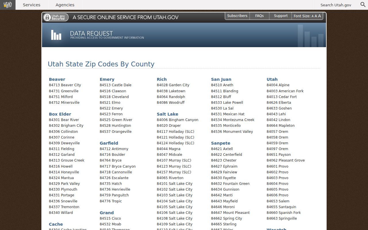
The state-list capture supports the two-ZIP reading. It should be read alongside the county and USPS routes.
84010 and Bountiful Street Delivery
The county city-by-ZIP source maps Bountiful to 84010 for its ordinary service geography. That is a useful first filter for a Bountiful resident lookup or address request. It is not enough to decide whether an address falls inside the municipal boundary, because postal names and city limits often differ. Use the property map for the physical parcel and the official city or county map for civic context.
A ZIP search can reduce a name list or help check a mailing label. It cannot identify every person at an address. The voter form uses City and Zip as search fields, and unclaimed-property search can use city and ZIP, but both are subject to the source's own scope and privacy rules.
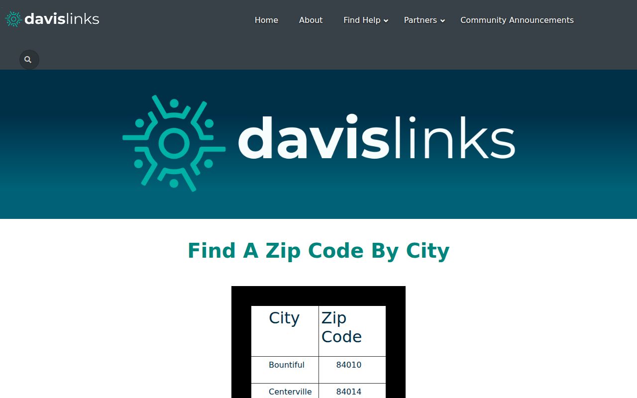
The county mapping capture illustrates why 84010 is the standard county city filter for Bountiful.
84011 Needs a Postal Check
Because the Utah official list also assigns 84011 to Bountiful, treat 84011 as state-listed postal geography rather than silently folding it into the county's 84010 city mapping. The inspected USPS capture target did not return a live Bountiful result, so the USPS city-and-state lookup remains the right verification step for a specific mailing address.
Search the official state list first. Then enter the city and state in USPS ZIP Code Lookup. Keep the result date and the complete address. If the postal label and the municipal or parcel label differ, preserve both instead of changing one to make a search match.
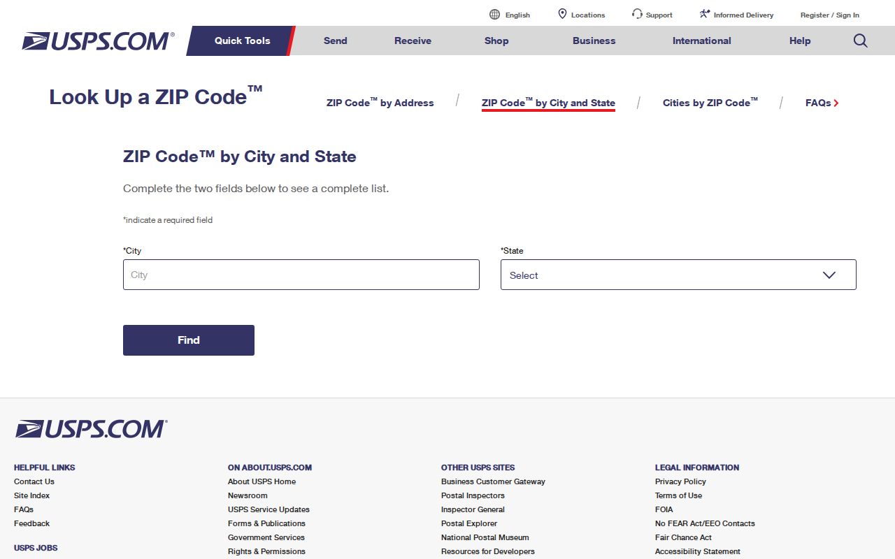
The USPS capture is the correct postal route, though the research notes that a live Bountiful result was not captured.
ZIP Geography Versus City Limits
A ZIP code is a postal delivery area. It is not a city boundary, tax parcel, voting precinct, or legal description. Bountiful's county and state sources make that distinction visible. A small-area map may group ZIPs for analysis. A mailing address may carry a Bountiful label while a parcel sits in another city. A property card gives the situs and legal description that land research needs.
- ZIP code
- A postal routing area used to sort and deliver mail.
- ZIP+4
- A more precise postal extension for a delivery segment or location; do not infer it from a city label.
- PO-box ZIP
- A ZIP associated with a postal facility or box service, which may not describe a home's physical parcel.
- Unique ZIP
- A ZIP assigned to a single large organization or special delivery use; it is not a general city resident area.
- Carrier route
- A delivery path within a postal area, distinct from a municipal boundary.
When a ZIP and city disagree, use the source suited to the question: USPS for mail, Davis GIS for a parcel, Elections for a voter record, and the city or county for civic jurisdiction.
Find Residents Within a Bountiful ZIP
A ZIP-keyed resident search should narrow the question before it narrows the names. A ZIP can help with a voter form or an unclaimed-property result, while a parcel map can confirm the physical location of a particular address. Do not ask a ZIP code to supply a complete resident list.
- Confirm the ZIP through the Utah list and USPS, noting the date.
- For a known person, enter name, city, and ZIP in Utah Voter Search when those fields are available.
- For unclaimed property, use the official MyCash search with last or business name; first name, city, and ZIP are optional.
- For land, search the Davis Property Search map by address or parcel ID, select the dropdown match, and open Parcel Details.
- Carry the parcel ID or legal description to the Recorder when the task becomes an ownership or deed question.
This workflow keeps postal and land records distinct. A ZIP result is a lead. A parcel result is a mapped place. A voter result is a registration record. Each needs its own source note.
Search ZIP in the Voter Lookup
Utah Voter Search displays First Name, Last Name, Date of Birth, Street Address, City, and Zip. Public fields can include name, physical or mailing address, year of birth, party affiliation, and vote history. Full date of birth, Social Security number, ID number, email, and phone are withheld. Protected voters can be excluded.
Use ZIP as one filter with a known name. The record does not show every household member and does not create a street-by-ZIP resident directory. Utah's May 25, 2026 privacy transition means the live privacy and data-request pages should be checked before relying on current field treatment.
Search ZIP in Utah MyCash
Utah's unclaimed-property search is a different ZIP-based clue. The official form requires a last or business name, while first name, city, and ZIP are optional. A match points to Utah-held unclaimed property and a claim path. It does not prove a person's home, current address, or relationship to Bountiful.
The 2026 Utah Treasurer outreach reported 23,100 visitors, 10,500 properties, and $2.35 million claimed, plus automatic matching for amounts up to $2,000. Those campaign figures explain why the route can be useful, but the claim process and current details belong to the Treasurer. Search the official site directly and do not pay a caller for access.
ZIP, Situs, Mailing, and Legal Keys
Four values can appear in one Bountiful inquiry: ZIP code, situs address, mailing address, and legal description. A ZIP describes postal routing. A situs address describes the physical parcel. A mailing address describes where correspondence goes. A legal description names the lot, unit, subdivision, block, or metes-and-bounds land. They can point to the same place, but they are not interchangeable.
The Property Search map links a clicked parcel to Tax Information, where parcel ID and legal description can be found. The Recorder handles ownership and legal-description questions. The Assessor handles valuation. The Treasurer handles taxes. Use a ZIP to find or check an address, then use the parcel and legal description for the land record.
Bountiful by Design is a current civic-geography source adopted December 9, 2025. It can frame future land-use context, but it is not a ZIP or resident directory.
Bountiful ZIP Context in Census Data
Census QuickFacts gives city context rather than a person list. It estimates Bountiful's July 1, 2025 population at 44,988, with a 2020 census population of 45,762 and 2010 population of 42,552. The city covers 13.19 square miles, and the 2020 density was 3,468.4 people per square mile. These numbers describe the municipality and should not be used as a ZIP-level count.
The 2020 to 2024 estimates include 14,523 households, with demographic figures such as 86.0% White alone, 8.3% Hispanic or Latino, 0.8% Asian, 1.8% Native Hawaiian or Other Pacific Islander, and 8.2% two or more races. They are context, not identity-search filters. A ZIP directory should use official postal and parcel sources for individual address work.
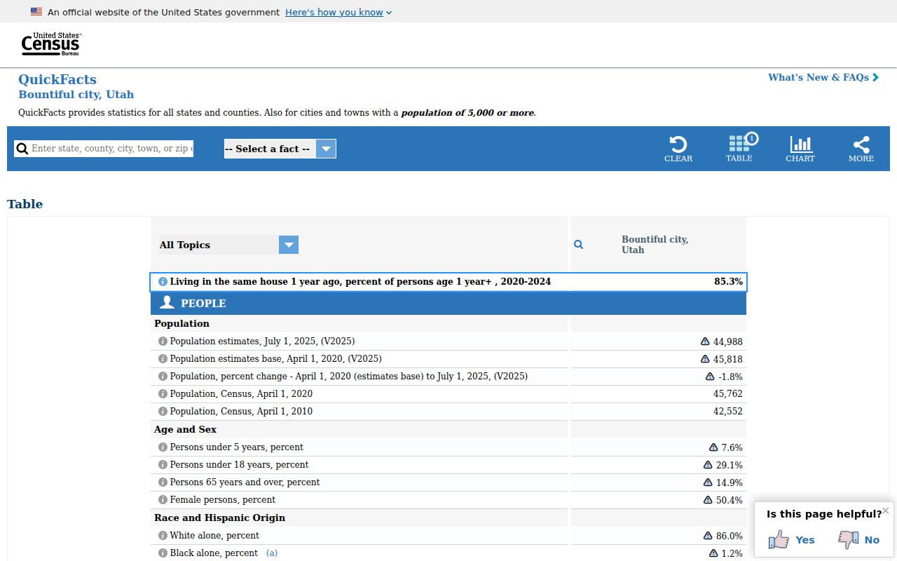
The QuickFacts capture provides municipal context and should not be mistaken for a list of residents by ZIP.
Request Missing Bountiful ZIP Data
The research did not locate a verified official ZIP-station detail page or a complete public ZIP-level resident file. When an address, map, or postal detail is missing, ask the correct custodian. Use the county or city GRAMA route for a public map, planning, or address record. Use Utah's open-records portal for a state-held file. Use USPS for delivery verification. Use the Recorder or Assessor for parcel facts.
A GRAMA request should name the agency, date range, street or parcel, record type, and desired electronic format. Inspection has no fee, while copies, staff time, and media can have actual-cost charges. The ordinary response target is no more than 10 business days, and a denial can be appealed within 30 days. A request cannot open a protected voter, sealed court, or confidential Safe at Home address.
Once a ZIP has narrowed the search, shift to the Bountiful street directory for parcel-level work. Street and ZIP are related filters, not the same record.